Traveler's Guide
East Macedonia & Thrace
Samothraki
Samothraki, island of the Great Gods
The name Samothraki derives from the prohellenic word ‘samos’, meaning altitude and ‘Thrace’ and translates as High Thraki.
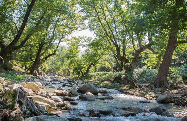
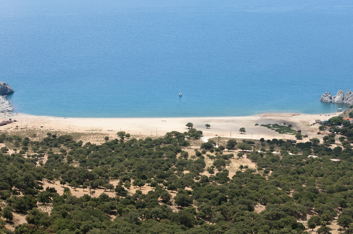
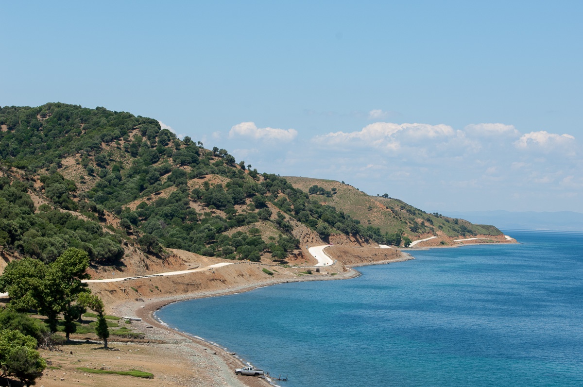
Samothraki is a place of exceptional natural beauty with wild un-spoilt nature, hidden rocky slopes, rich flora and fauna, plane forests, which often reach the shore, pine trees, chestnut trees, cedars and Mediterranean bushes, an abundance of running water, cataracts, ponds – known locally as ‘vathres’ and enchanting seashores. The water in Samothraki, due to its quality and cleanliness, has been designated one of the 4 best seas in Europe. It is known worldwide thanks to the famous 2.75 metre high ancient Greek statue of Victory, discovered on the island in 1863 and now on show at the Louvre Museum in Paris.
Sacred land and unparalleled religious centre in ancient times, it knew undiminished popularity until the 3rd century AD. Well known for the Kaviria Mysteries, to which, as opposed to the Eleusinian Mysteries, freemen, slaves, men and women, both Greeks and foreigners were admitted. It was the first port of call for Paul the Apostle on his first journey in Europe.
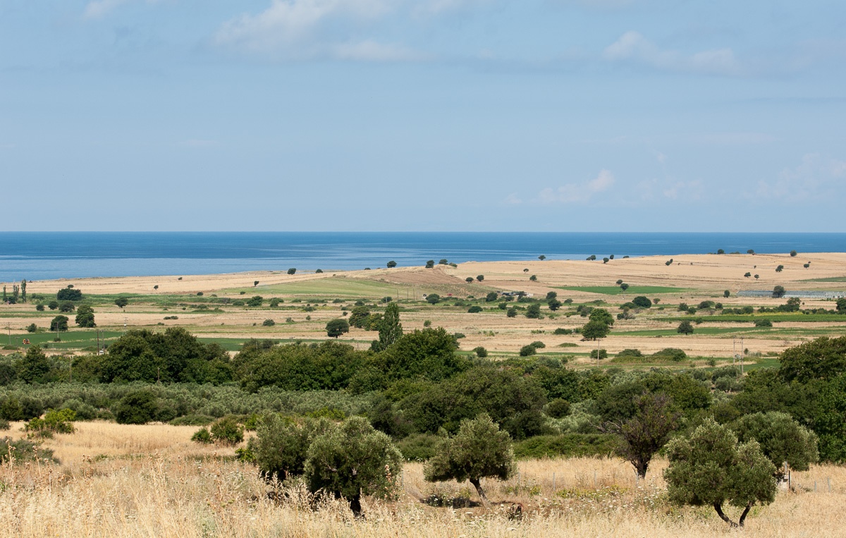
On undertaking a trip around Samothraki, it at first seems as if there are two different islands: the north and north-eastern side are verdant: green slopes, perennial forests, fruit crops, dense bush growth, impressive cataracts in forest streams. In the south and south-west there are low hills and hidden rocks which rise above the sea, sparse vegetation, fields and olive groves.
The unchanged character of the natural environment, due to relatively low tourism, its rare beauty, the presence of indigenous plants and important bird habitats, have resulted in most of Samothraki’s inclusion in NATURA 2000 Areas. The presence of the local Ibex is also unique. Monachus monachus and porpoises (only present in the North Aegean Sea) can be found in the sea here.
Also unique is the institution of land ownership here with its high proportion of landowners and undistributed lan. Land is measured according to the number of animals and its geographical position (mountain, plain, hillside), a peculiar kind of communal ownership which began centuries before and has remained unchanged until today.
Archaeological sites smothered in greenery, castles and towers which were erected by the Genoese, picturesque settlements with narrow cobbled streets and earthen roofs. An unbeatable natural and manmade environment.
Location
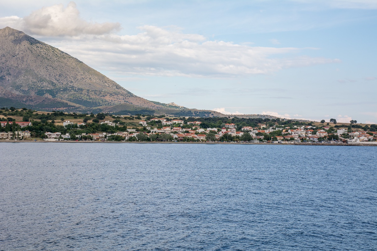
The island of Samothraki is in the Thracian Sea. It is a short distance from Limnos, Imvros and Thasos, 24 nautical miles from Alexandroupoli. Samothraki is oval shaped, 178km2 in area and its shoreline is 59km. It dominates the North-eastern Aegean, thanks to impressive Mount Saos, Feggari, the third highest peak (1,611m) in the Aegean, after Psiloreiti (Crete) and Dirfi (Evia). Samothraki is administratively attached to the Region of Eastern Macedonia- Thrace and constitutes a Municipality of the same name. Its permanent population, according to the census of 2011, is 2,840 residents.
It can be reached by ferry mainly from Alexandroupoli, via Kamariotissa Port. It relies mainly on tourism and fishing for a livelihood. It is a suitable destination for seaside and spa tourism, for touring and hiking, cultural and religious tourism, as well as alternative tourism.
Address
No information available.Contact Information
No information available.


- [Home][CULTURE][RELIGION]
- [NATURE]
- BEACHES
- FORESTS
- WILDLIFE SHELTERS
- CANYONS
- RIVERS
- CAVES
- NATURA
- LAKES
- WATERFALLS
- HOT SPRINGS
- MOUNTAINS
- PARKS
- AGROTOURISM
- ALTERNATIVE
- MUSEUMS
- SIGHTS
- [CONFERENCE ][ACTIVITIES][INFORMATION]
- [ΑCCOMMODATION][FOOD AND DRINK][ΤOURIST SERVICES]
- [POINTS OF INFORMATION][HEALTH][COMMERCE]
- [ENTERTAINMENT]
Privacy Policy
Intellectual and Industrial Property Rights - Responsibility of the Site and the Region of East Macedonia & Thrace
The content of this portal has been collected and evaluated by each partner of the project (Region of East Macedonia & Thrace, Regional Administration of Smolyan, Regional administration of Kardzhali και Regional Administration of Haskovo) for the area which each partner represents. Each partner represents each region for the implementation of the Action 3.2 "Content Collection" for the approved applitcation form of JTI - TARGET project under "Greece - Bulgaria 2007 -2013" Interreg Call. The content including images, photos, graphics, texts, textures and in general all the data of the portal is in the responsibility of each partner. The content update and upload of each region belongs to each partner which has also the copyright for those content. This means that the content in this portal of all the point of interests of the Region of Smolyan belongs to the Partner Regional Administration of Smolyan. The content in this portal of all the point of interests of the Region of Haskovo belongs to the Partner Regional Administration of Haskovo, The content in this portal of all the point of interests of the Region of Kardzhali belongs to the Partner Regional Administration of Kardzhali, The content in this portal of all the point of interests of the Region of Region of East Macedonia & Thrace belongs to the Partner Region of East Macedonia & Thrace.
Given the nature and the size of the Internet, under no circumstances, including the case of negligence, will the Region of East Macedonia & Thrace is not responsible for any kind of loss caused to the visitor/user of the pages, services, choices and contents of this portal, which one undertakes at one’s own initiative. The portal and the Region of East Macedonia & Thrace do not guarantee that the pages, the services, the choices and the contents will be provided non-stop and without errors and that the errors will be corrected, because each content belongs to the Region that belongs. Furthermore, the portal and the Region of East Macedonia & Thrace do not guarantee that the servers, through which it is made available to users, do not contain “viruses” or other harmful contents. The Region of East Macedonia & Thrace guarantee the correctness, completeness or even the availability of the contents, pages, services, choices or their results only for its Region, not for the other Regions.
Links to other Websites
The Portal and the Region of East Macedonia & Thrace do not control the availability, the content, the personal data protection policy, the quality and the completeness of the services of other web sites and pages to which it directs users through hyperlinks. Consequently, for any problem arising during their visit/use, the user has to address directly the corresponding web sites and pages, which have the full responsibility for the delivery of their services. The Portal and the Region of East Macedonia & Thrace can under no circumstances be considered to agree with or accept the content or the services of the web sites and the pages to which it directs users or to be associated with them in any way.
Applicable Law and other Conditions
The aforementioned terms and conditions of the use of the Portal, as well as any modification of them, are governed and completed by the Greek law, the law of the European Union and the relevant international treaties (like indicatively and not restrictively the Law 2472/1997 for the protection of the individual and the protection of personal data, as completed by the decisions of the Chairman of the Committee for the Protection of Personal Data, the Presidential Decrees 207/1998 and 79/2000 and Article 8 of the Law 2819/2000, as well as the Law 2774/1999 and the European Law (directives 95/46/EC and 97/66/EC). Any provision of the above conditions that becomes opposing to the law, it ceases to apply by right and is removed from the present, without the validity of the remaining conditions being affected in any case. No modification of these conditions will be taken into account and will be part of this agreement, unless it has been officially formulated and incorporated into it.
